SRA Annual Report 2020-21: Trees for Water
Trees for Water action fund
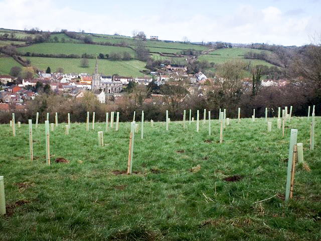
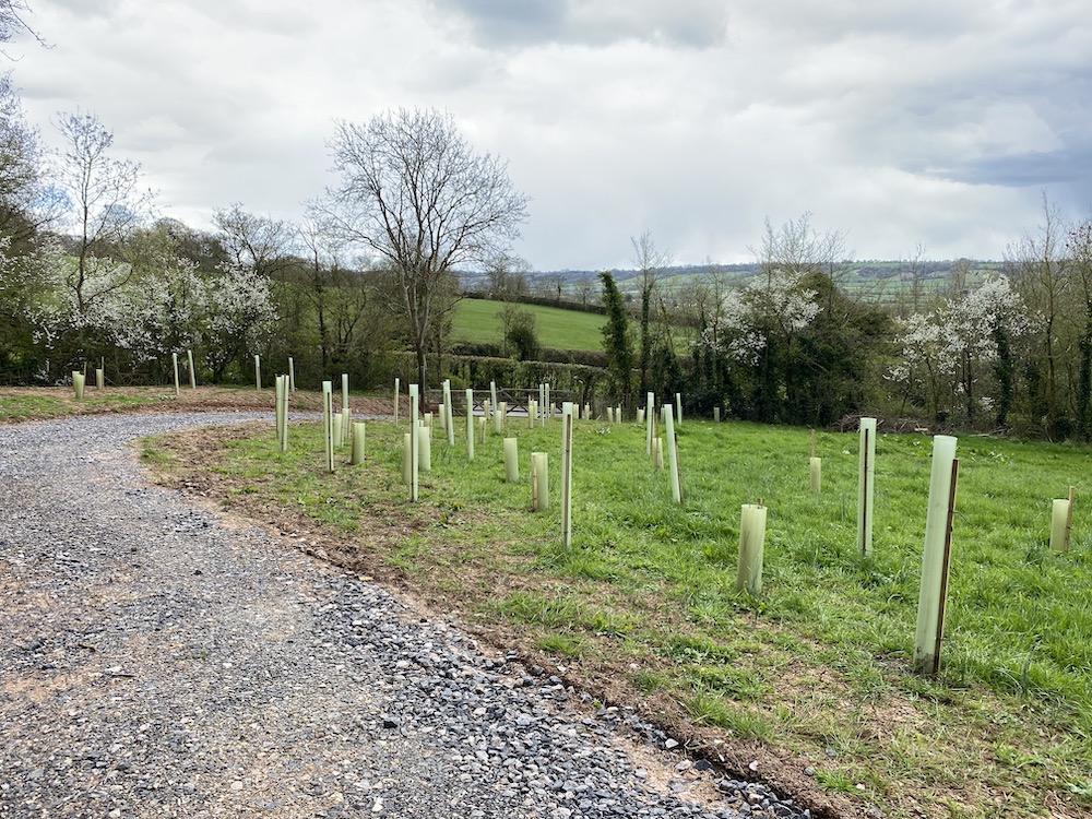
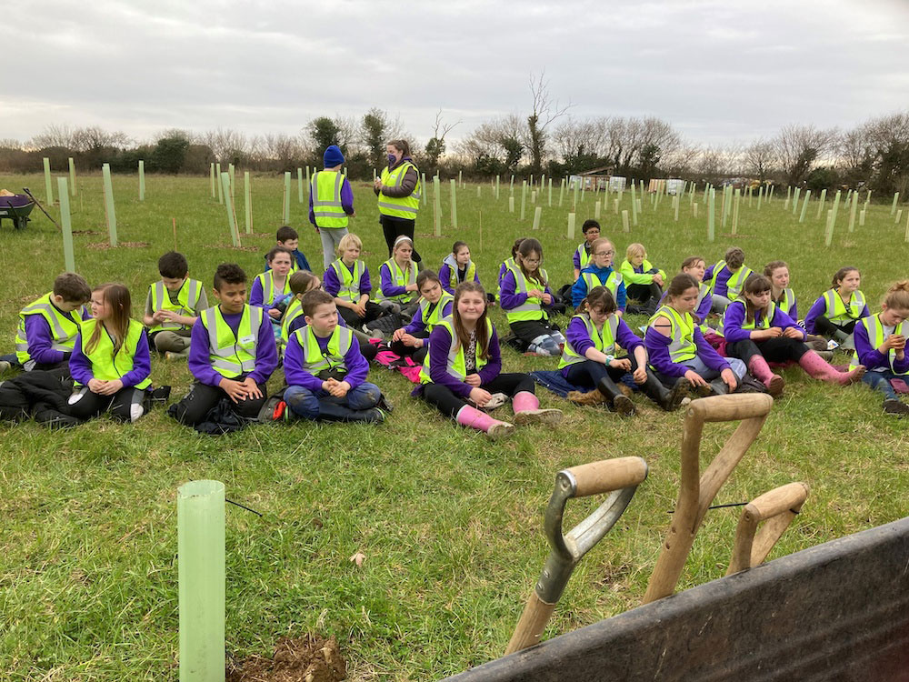
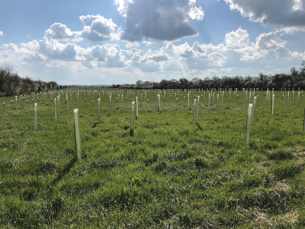
An action fund designed to help communities reduce flooding problems caused by surface water run-off. The project is run by Reimagining the Levels in collaboration with the Farming & Wildlife Advisory Group SouthWest (FWAG SW). It is funded by the SRA, and was backed by the Woodland Trust in 2020-21 with 12,000 free trees and shrubs. Despite the challenges of the coronavirus pandemic, the project had a successful year. Enthusiastic volunteers regularly turned out for socially-distanced planting sessions, at 23 places. In total they dug in 3,645 trees and 2,638 shrubs.
Trees for Water is particularly designed to suit strategically important sites not large enough for Countryside Stewardship grants and not special enough in conservation terms to concern Natural England. It is meant to be flexible, bespoke and un-bureaucratic.
In March 2021 the SRA Board approved more funding to enable the project to continue. In 2020-21 Trees for Water mostly targeted Mendip and South Somerset district council areas. In 2021-22 it is planned to include more sites in Somerset West and Taunton, and Sedgemoor.
Mendip
Butleigh, Wyld Lea, 194 trees and 106 shrubs planted at the top of a sloping field on the outskirts of Butleigh, combined with 40 metres of cross-slope hedge planting, to help slow the flow of water into a stream that feeds into the River Brue, and to help restore structure and health to damaged soil, and to provide wildlife habitat.
Croscombe, 122 trees, 178 shrubs, planted in an acre of steep land near Hillview Cottage, with 75m of fencing, to extend some existing woodland along the hillside. The site is above an area that regularly floods in the centre of Croscombe, so the aim is to help reduce run-off down to the village and the River Sheppey.
North Wootton, Folly Lodge, 56 trees, 64 shrubs, to slow the flow of water down from farmland onto Pilton Hill Road, which is susceptible to localised flooding, and also down into the rhynes and ditches east of Glastonbury, which join the River Brue.
Wanstrow, 83 trees, 62 shrubs, planted in a field with compressed clayey soil that was, until recently, regularly sown with Italian rye grass using heavy machinery, so the level of surface water run-off was described by the parish council as “very high”. The aim of two new woodland areas is to reduce the flow of water into a stream which flows through Wanstrow, where restrictions at two small bridges cause flooding after heavy rain, and then goes onto Nunney, identified by Mendip District Council as an area needing natural flood management activities to reduce flood risks.
Sedgemoor
Heath House hamlet near Wedmore, 170 trees, 100 shrubs, planted in a field which slopes quite steeply down to Landsend Fishery on the edge of Tealham and Tadham Moors, to help slow the flow of water down to a complex system of drains and rhynes feeding into the River Brue a mile south.
Huckham, 90 trees, 60 shrubs, 110 metres of fencing, along the contours of a steep slope that drops down to Butleigh Moor, to help reduce run-off into Sutton Rhyne and other ditches and rhynes, that eventually feed into the River Cary.
Somerset West and Taunton
Between Knapp and Ham, Knapp Lane, 30 trees, 30 shrubs, 30m of hedge planting, with 110m of stock proof fencing, to help slow the flow of water into a watercourse which joins the River Tone near Ham Weir, and to help reduce the risks of local road flooding.
Haymoor, 730 trees, 390 shrubs, 630m of stock proof fencing, on 3.5 steeply sloping acres of the North Curry ridge, right above Haymoor, which is part of the floodplain of the River Tone a few fields to the north. Woodland on ridges separating moors is a characteristic feature of the Somerset Levels and Moors.
Newport, land near Withy Cottage, 29 trees, 29 shrubs, 36m of fencing, to help reduce run-off along the road to North Curry, and into two watercourses which feed into West Sedgemoor and the River Parrett at Stathe.
Newport Hill, The Farmhouse, 20 trees, 30 shrubs, 90m of hedge planting, to help reduce run-off from a large field into the stream which becomes Sedgemoor Old Rhyne and eventually flows into the River Parrett. The A378 main road from North Curry to Langport is susceptible to flooding where this stream goes under the road at Newport, and further down near St Giles Kennels.
South Somerset
Barrow Hill, near Milborne Wick, 175 trees, 185 shrubs, planted in five different areas with 330 metres of fencing, on both sides of the main Exeter to London railway line, which goes south- west – north-east through the middle of the land on a high embankment. The River Gascoigne runs along the south/south-west boundary of the land, under the railway line and on to its confluence with the River Yeo near Sherborne Lake. At Barrow Hill the Gascoigne rises fast during periods of heavy rain as water flows down from several places, including Stout Hill, Charlton Horethorne and the spring at Bradley Head. Planting trees and shrubs here was the first phase of a two-stage plan to reduce local flood risks in this catchment, improve water quality, and benefit wildlife.
Bruton, Coombe Farm, 35 trees, 80 shrubs, planted in a valley on the northern outskirts of the town, to help slow the flow of water into Coombe Brooke which joins the River Brue, and to diversify and extend existing woodland sadly prone to ash dieback.
Bruton, Tolbury Lane, 45 trees, 35 shrubs, planted in a three-acre field on the north-west outskirts of the town to help reduce run-off into Coombe Brook, which joins the River Brue in the centre of Bruton, and also to help alleviate a local road flooding problem.
Chaffcombe, 50 trees, 50 shrubs, planted in a small basin-shaped valley sloping westwards below Windwhistle ridge, to help reduce run-off down towards Chaffcombe, where roads flood, and into a tributary of the River Isle and then the River Parrett.
Compton Dundon, Bartletts Farm, 70 trees, 50 shrubs, 30m of hedge planting with four hedgerow trees, 250m of stock proof fencing, to increase infiltration and help reduce run-off from the lower slopes of Lollover Hill, on the edge of Compton Dundon and King’s Sedgemoor.
Curry Rivel, 268 trees, 132 shrubs, planted on land owned by the charitable Curry Woods Conservation Trust at the highest point of Curry Rivel parish, known locally as the ‘continental divide’ of South Somerset, because water runs off in two directions. To the south, into the Water Street catchment: to the north, into West Sedgemoor. The Water Street area of Curry Rivel once had a series of medieval ponds. These have been drained. It now has various buildings including a primary school. In the last decade, the school has flooded twice, with repairs costing more than £20,000 each time.
The Curry Woods Conservation Trust was launched in 2019 to buy land at the top of the Water Street catchment, partly so that moves could be taken to slow the flow of water from its source. More planting is expected in an area of former arable land after this year’s start through Trees for Water.
Curry Rivel Parish Council also worked with FWAG SW on the Water Street scheme described on page 28. This scheme has reduced – but not removed – flood risks.
Huish Episcopi, sloping land off the B3153 on the eastern outskirts of the village, 116 trees, 64 shrubs, 0.6 acres of planting to help slow the flow of water down to two properties and to Wagg Rhyne and then Long Sutton Catchwater and the River Parrett.
Long Sutton, Landmoor Lane, 627 trees, 348 shrubs, planted in two parts of a long field on Land Moor quite close to the River Yeo, to slow the flow of water into Long Sutton Catchwater and then the River Parrett at Langport.
Long Sutton, Twelve Acre Farm, 150 trees, 115 shrubs, contoured across the centre of two sloping fields, and 125m of hedge, along the lower edge of a field, to help slow the flow of water into a stream which joins Mill Stream at Knole, thence King’s Moor Drain, the River Yeo and finally the River Parrett. The planting is helping to reduce run-off onto roads, and the woodland strip also serves as a shelter belt for crops.
Martock Recreation Ground, 160 trees, 140 shrubs, planted in land owned by Martock Parish Council, to reduce run-off into Western Brook, then Hurst Brook, in the catchment of the River Parrett, and lessen flood risks locally and further downstream.
Pitney, Glebe Farm, a total of 130 trees, 70 shrubs, 54m of hedge, 200m of stock proof fencing, at two sites, one near Westerngate Road to reduce run-off and soil erosion into ditches and to the road, the other across the middle of a field nearer the farm buildings, to reduce run-off and soil erosion.
Pitney, near Park Lane, 450 trees, 250 shrubs, 220m of stock proof fencing, in a strip curved along a slope below some ancient woodland, to help reduce the amount of water flowing down the hill to Park Lane which periodically floods, and down towards the rhynes and ditches that feed into the River Cary half a mile away.
Sparkford, 145 trees, 70 shrubs, planted as linear woodland to help slow the flow of rainwater down from land that slopes south-east towards the River Camel upstream of Queen Camel, which has a history of flooding.