SRA Annual report 2020-21: Triple C match-funded natural flood management schemes
Triple C match-funded schemes
The EU’s Interreg 2 Seas programme has so far part-funded 34 Hills to Levels schemes through the Triple C initiative, which began in autumn 2017. Triple C was due to finish in December 2020 but has been extended until December 2021 because of the coronavirus pandemic. The three Cs stand for Climate resilient, Community-based and Catchment planning and management. The funding split has generally been EU 60%, Somerset Rivers Authority 40%. A video made in the summer of 2020, much of it in torrential rain, shows some Triple C highlights: see Hills to Levels – Triple C flood works in Somerset on YouTube – https://youtu.be/hA3N3O5XLdE
Mendip
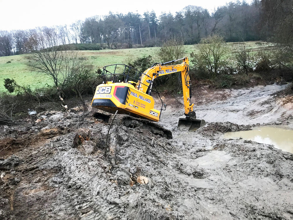
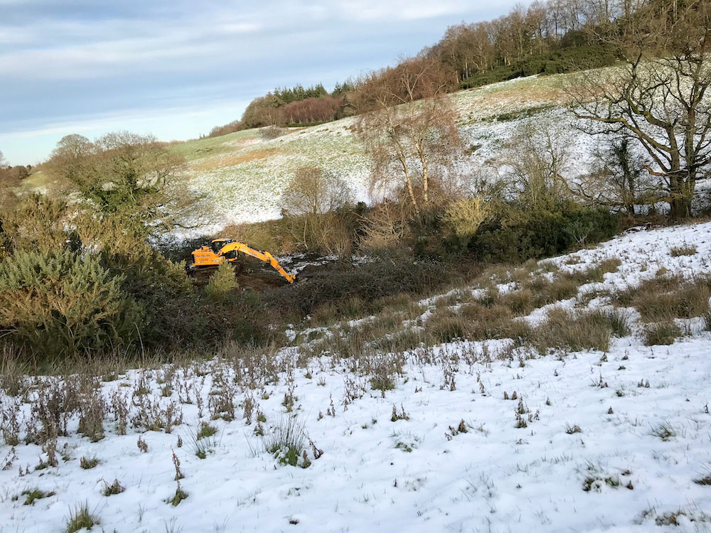
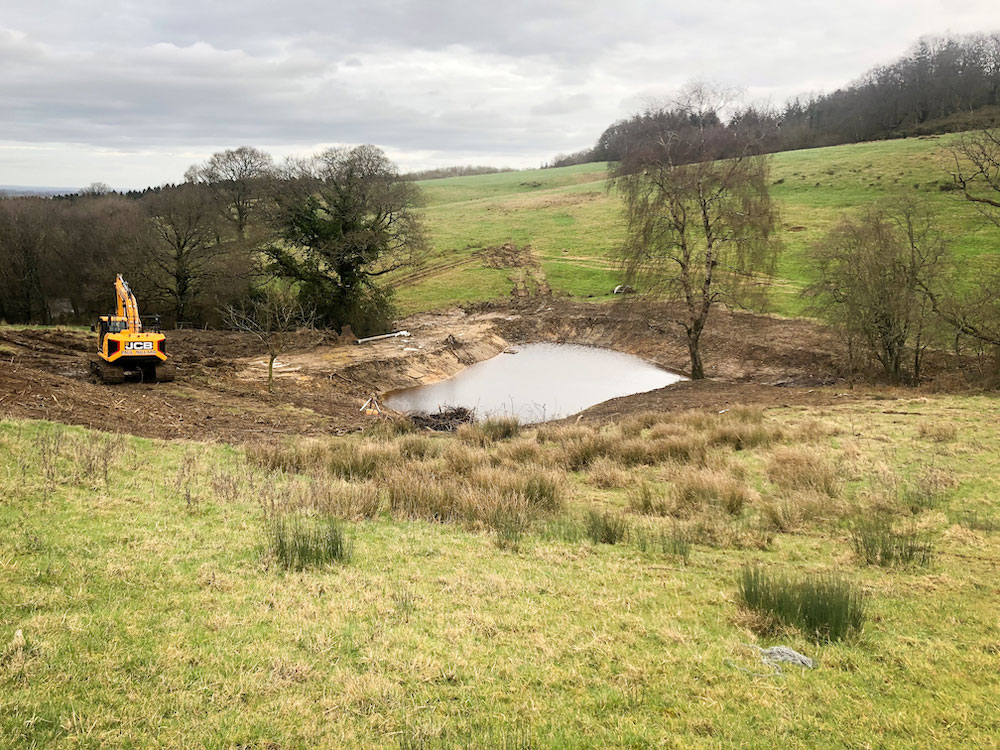
Witham Friary, Witham Park Farm, near Frome, Somerset Frome catchment. A pond has been restored, to provide a significant amount of winter water storage and so help slow the flow in a flashy catchment. A large amount of silt was taken out (at least one metre in depth) and 10 years’ growth of scrub removed. The pond was not storing any water, because its bund had also been breached. A new, much more substantial bund (four or five metres wide) has been created and a leaky outlet installed for the gradual release of water. The bottom photo was taken the day after heavy rain. They show the pond doing its job.
Somerset West and Taunton
Black Hill and Cothelstone Hill, Quantocks: A two-pronged scheme designed to reduce run-off along tracks classified as public footpaths. On Black Hill, water running off towards Crowcombe Combe Road was eroding the track as it travelled down, then depositing debris on the road below. Two stone grips were installed to direct water away from the track into adjacent fields, and to help reduce soil erosion along the track. Previously eroded parts of the track were infilled.
From the Cothelstone Hill track, water was running straight onto Cothelstone Road, again eroding the track, then causing road problems. Five stone grips were installed along the track to divert water into soakaways in a field, thereby reducing track erosion and lessening highway problems. Monitoring has shown the grips work well during downpours. All grips were constructed with local stone.
Meare Green: At one site a 200m2 pond was restored, at another a ditch was cleared and 160 metres of stock-proof fencing installed. Monitoring has shown the pond now captures a substantial amount of water, and the fence prevents bank erosion by livestock, thereby helping to reduce the amount of sediment getting into the watercourse.
Thorne St Margaret, Rewe Farm, upper Tone catchment. A pond was created to temporarily store water from a nearby stream, which rises rapidly and makes downstream Bughole Lane prone to flooding. There are two levels in the pond. A small but deep central part was lined with puddling clay to create a more permanent area of water for wildlife: above that part, up to 70 centimetres of floodwater can be held. The local soil is Crediton Series Wetness Class 1, so freely draining, which means that water seeps in and out of the pond through infiltration. It is fenced to limit poaching by livestock.
South Somerset
Montacute: A sophisticated scheme along Mill Stream and on part of its floodplain, designed by FWAG SW in partnership with the National Trust, on land owned by the National Trust between Montacute House and the A3088 near Yeovil. Its main purpose is to help slow the flow of water down through part of the Wellhams Brook catchment, which feeds into the River Parrett, by re-naturalising the stream in several different ways, and storing more water for longer on its floodplain while also creating new habitats for wildlife. New features include:
- Shallower bank-side slopes with berms designed to help slow the flow of water, and create new marginal habitats.
- Log deflectors made by hingeing trees into the watercourse and securing them with wooden stakes, to reduce bankside erosion and trap and accumulate sediment that would otherwise flow down towards Wellhams Brook.
- Leaky woody dams to help slow the flow of water and trap and accumulate sediment.
- Log steps made by fixing small logs up against the river bank, so that scour pools are created by overtopping water, and more water is stored upstream because of backing-up (a ‘backwater effect’ like a traffic jam caused by a hold-up).
- A flow spreader that stretches out from the stream onto the floodplain to encourage water to spill out from the channel.
- An inlet swale (ditch) leading from the flow spreader to two big scrapes (ponds).
- Two scrapes in the floodplain with a surface area of 1,400m2, linked by a swale so that one scrape fills after the other, both swales with shelved sides graded down to a depth of 1.2m.
Water flows back down to Mill Stream across the grass via a re-profiled shallower bankside slope.
The swales and top edges of the scrapes were covered in coir matting and re-seeded with a wetland wildflower mix, and fences were put up to protect against grazing livestock.
Special areas for wildlife include a backwater created as a place for spawning frogs, and as a refuge for fish during times of fast river flows.
Some trees were felled along the banks of the stream to allow for more light to help plants and creatures such as dragonflies.
Logs and brash from these trees, as well as earth excavated from the ponds and scrapes, were used to create two very large hiberniculas, to serve as shelters for reptiles, amphibians, birds, bees, small animals and insects.
In short, this site is a kind of compendium of natural flood management activities in Somerset.
Odcombe: During periods of heavy rain, water was overtopping the bund of a pond used for water storage in the Wellhams Brook catchment, and causing a bank to slump into a stream. An overflow pipe was therefore installed to divert excess water straight from the pond into the stream, to protect the bank from collapse and stop completely uncontrolled outward flows. Coir matting was also laid to further protect the bank.