SRA Annual Report 2024-25: Natural Flood Management schemes across Somerset 2024-25
Somerset Rivers Authority funds many land management and Natural Flood Management (NFM) activities across Somerset. Various techniques are used, singly or in combinations designed to suit to local needs and conditions. All share the aim of reducing local flood risks, by slowing the flow of water down through catchments to vulnerable areas, in ways that work with nature. This workstream is led for the SRA by the Farming & Wildlife Advisory Group SouthWest (FWAG SW).
Activities since 2015 have generally gone under the popular local branding of Hills to Levels. As awareness of this initiative has spread across Somerset, and as flooding has been getting more intense and unpredictable, more people have been saying that they want to help reduce flood risks where they live. However, people have also been saying they lack technical expertise, knowledge and confidence. In 2022, therefore, the SRA agreed to fund some targeted assistance for people found to be highly motivated and activities judged to be effective.
A community sub-catchment enabling scheme was set up through FWAG SW, and the SRA Board topped up funding for this scheme in September 2024. Several of the projects described below have come about through communities working with one of the two officers employed by FWAG SW to help people turn ideas into action: namely Chaffcombe, Gothelney, Greinton, Kingston St Mary and Knole.
Other projects have come about more conventionally through FWAG SW advisors working with farmers and landowners. In several of these schemes, as part of thinking about dealing with the infiltration or runoff of rainwater as close as possible to where it falls, greater emphasis has been put upon the assessment and management of soil: matters such as soil type, soil structure, soil health, drainage, tillage and cover crops. Examples include Brewham, Kingston St Mary and Montacute.
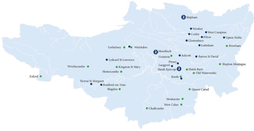
The map shows the locations of the NFM schemes described below (green dots), and also of Trees for Water Action Fund plantings (blue dots).
List of Natural Flood Management schemes in 2024-25
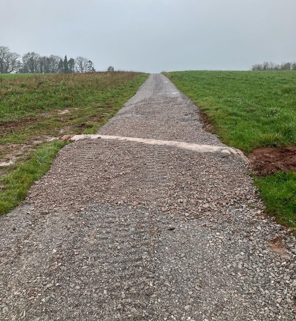
Twenty-four NFM schemes were completed across Somerset during 2024-25, the highest number since 2018-19. Schemes were:
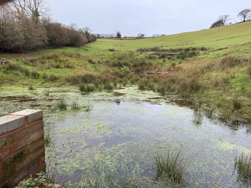
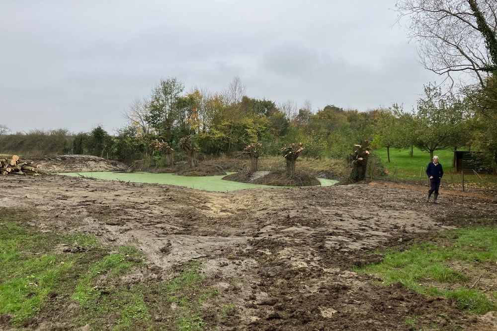
Blagdon Hill, Blagdon Green, River Tone catchment. A leaky pond (20 metres by 10 metres) was created to store water that is now diverted via a brash dam and pipe from a tributary ditch of the Sherford Stream, then released via another pipe back into said ditch. These new features – pictured below during construction – are on land owned by the registered charity known as Village Hall and Playing Field Pitminster and Angersleigh.
Brewham, Bridge Farm, Brue catchment, the first phase of a proposed two-part scheme.
To begin with, dying ash trees have been felled and hazel trees coppiced to make a series of flow spreaders placed to help slow the flow of water across a field and down through an area of hillside woodland straight into the River Brue. Three grey willows have also been planted to help stabilise sections of woodland badly eroded by torrential flows. A second phase envisages creating two leaky ponds in the field.
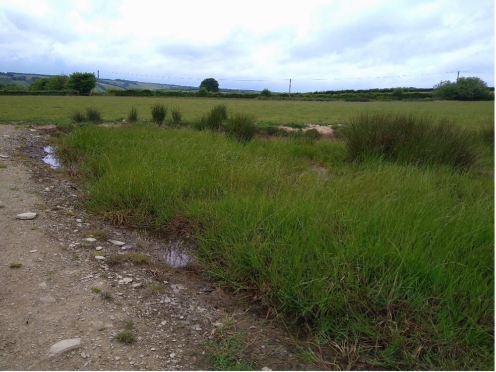
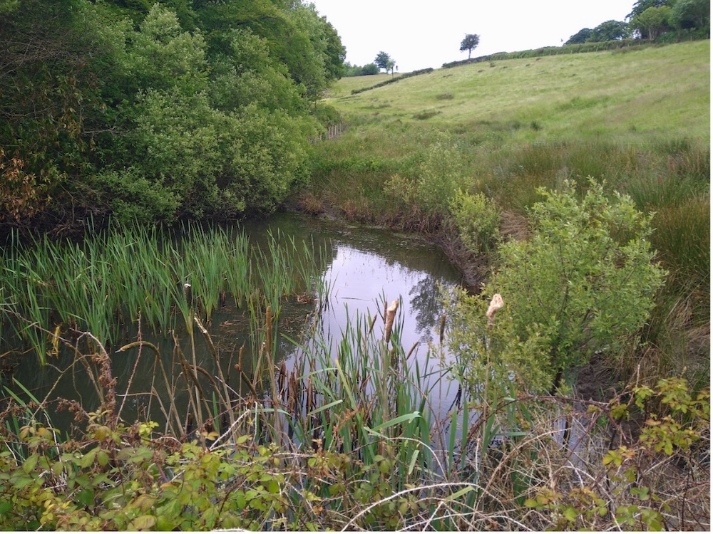
Woodlands, uphill of Chaffcombe, Upper Isle – River Parrett catchment, a pond has been created in the corner of a field near Knapps Lane to store water at a low spot where water was converging from steep fields above.
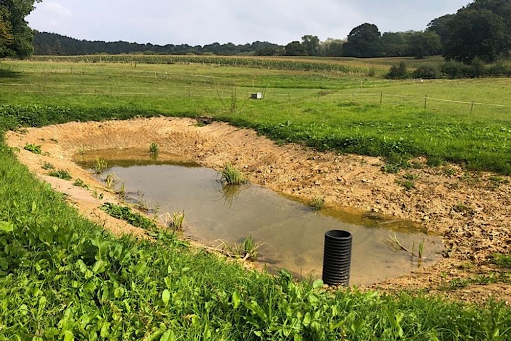
The pond is 13 metres wide and 18 metres long, and up to 1.3 metres deep. It has a leaky letterbox outlet pipe to allow a low flow out of the pond, but also to allow water levels to rise during periods of heavy rain. This extra storage helps to slow the flow of water and reduce flood risks downstream to a village that in recent years has suffered more frequent and more severe flash flooding.
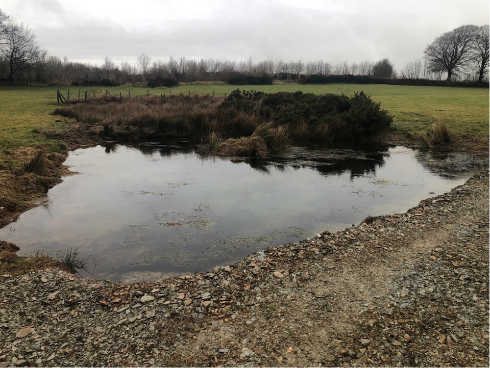
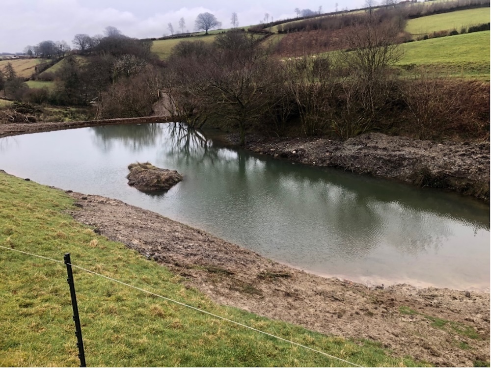
The Old Waterworks between Lytes Cary Manor and Charlton Mackrell, River Cary catchment, a former pumping station built in 1895. A scheme funded by Natural England and Somerset Rivers Authority, branching out from a large pond created in 2021, in a 5-hectare field next to the River Cary. At this historically important site, four big scrapes with connecting channels were created to help reduce flooding and produce a new wetland for wildlife. This job was done using a Liebrecht rotary ditcher imported from the USA by the RSPB: the only machine of its kind in the UK (pictured on the back cover of the printed and PDF version of this annual report – and below).
A digger was also used to smash old underground drainage pipes, fill in low areas and build up banks around parts of the field’s edge. The results of all this work were seen soon after its completion, during downpours in October 2024, when water levels in the Cary rose and the river bifurcated and flowed through the field for an extra 620 metres, just as analysis of its historic paleochannels had suggested that it would. These channels can be seen in the landowners’ drone shot below.
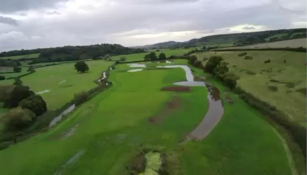
Similar events are expected to occur on average five times every winter, helping to hold back and store flood water. FWAG SW believe there are “significant opportunities to replicate this within the immediate vicinity should landowners be receptive to such interventions”. One such case has been at Huish Barn: see below.
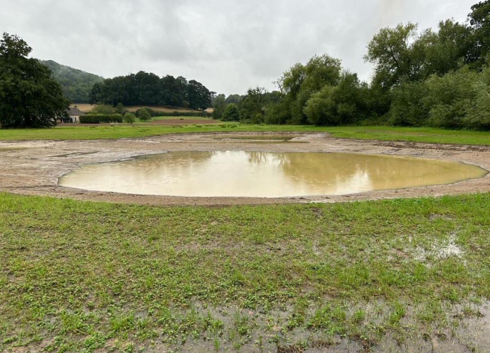
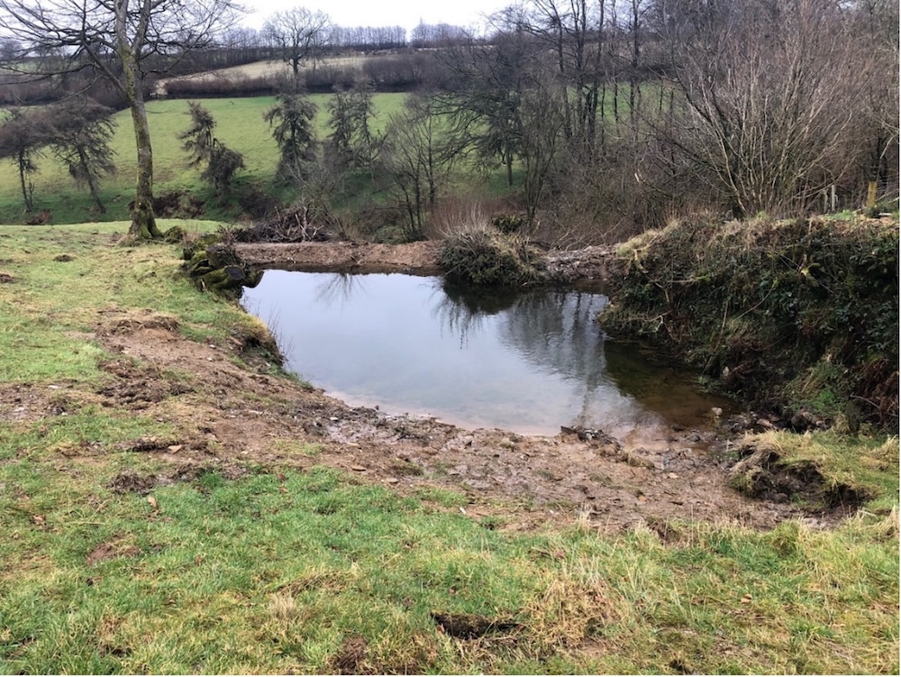
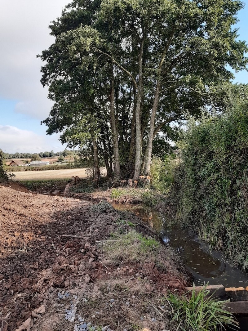
Land at Huish Barn, Huish Road, near Somerton, River Cary catchment. A wetland area has been created on land next to the River Cary, to help reduce flood risks downstream by slowing the flow of water across the river’s flood plain and using it to store more water. Existing field drains were removed to force water to flow overland, then a 65 by 50 metre pond was dug out. Additionally, earth moved during the making of this pond was spread over land outside of the flood plain. This spreading was done to reduce the land’s gradient so that water also flows more slowly over this land and more water can be stored. A further benefit is that the new wetland area is a better habitat for wildlife.
Higher Thorne Farm, Exford, Middle Barle – Upper Exe catchment. One pond was re-created, two enhanced, on a farm with steep land above Exford, near the B3224, so they could store and hold back water. The first pond – at the farm’s highest point, near a spring – was increased in size from a volume of 240m3 to 600m3. The second and middle (where a pond used to be) went from zero to 450m3, the third and lowest from 150m3 to 1750m3. The photographs below show the three ponds in order from top to bottom, before first, then after.
As well as deepening, works involved regrading banks, creating bunds, installing outlets, and erecting fencing to exclude livestock but allow access for future pond de-silting. Funding was split half and half between the SRA and South West Water.
Greinton, King’s Sedgemoor Drain catchment, a scheme to help reduce the flow of water which was overflowing down a track on the north side of the village towards properties and the A361 through Greinton. This stretch of road has had 11 recorded incidents of flooding since 2012. One of FWAG SW’s SRA-funded community advisors worked closely with Greinton Parish Council and a local contractor on interlinked moves to improve water management, including clearing and bunding an old pond so that water could flow through a new culvert into another pond, ditch and stream clearing and building up banks.
Greinton’s parish clerk told the SRA: “While this project is just one of many efforts to mitigate flooding in our village, we already see significant progress in reducing water flow and subsequent flooding, helping to keep our community safe and better prepared.”
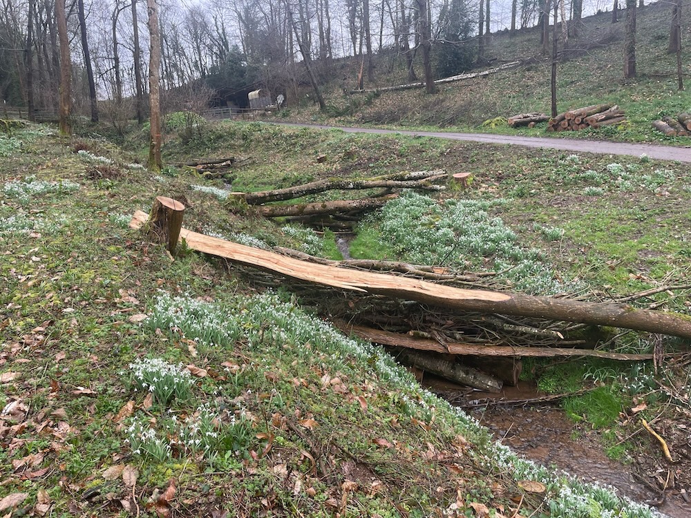
Kennel Bottom, Hestercombe House, West Monkton parish upstream of Cheddon Fitzpaine, Allen Brook (Maiden Brook) – River Tone catchment. Six felled ash trees from Hestercombe were used to create three leaky dams to slow heavy flows of water down through a combe towards the Hestercombe car park and beyond that down towards Cheddon Fitzpaine and Maidenbrook where West Monkton Parish Council has reported homes and roads flooding.
A further scheme is being considered by Hestercombe in West Combe to the west of Kennel Bottom. Hestercombe’s head gardener has thanked the SRA and FWAG SW for “a great project which should prove to have a tremendous impact upon the local community”.
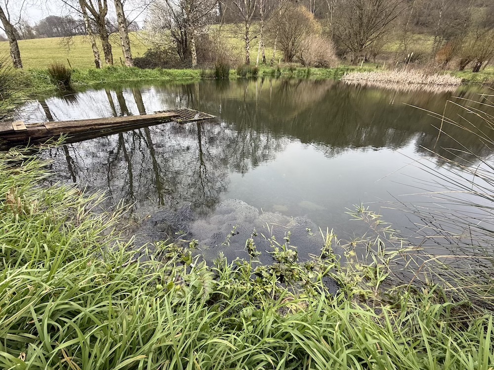
Kingston St Mary, Park Farm, Yarford, tributary of Back Stream, Tone catchment. Following a suggestion made by the owner of Park Farm to one of FWAG SW’s SRA-funded community sub-catchment enabling officers, an old pond was reinstated to help slow peak flows of flood water, down towards Pickney Lane and Cross Keys.
This area was highlighted as a concern by Kingston St Mary Parish Council, after flooding in December 2023. Works included coppicing and removing trees and their roots from the site of the pond, removing land drains, excavating, and designing and fitting a leaky outlet to the pond, to allow for more control over storage and flows (see below).
Manor Farm and St Benedict’s Farm, Knole, King’s Moor Main drain – Yeo – Parrett catchments, two interlinked schemes involving two neighbours, devised with support from the Parrett Internal Drainage Board and SRA-funded officers at FWAG SW, following flooding in Knole over the winter of 2023-24, and the formation of Knole Flood Group.
A pond on a flow pathway leading into the village from the west was desilted and expanded to create more capacity for holding flood water, and a leaky outlet was installed to allow for greater control of water levels. A bund was also created to push water off a neighbouring field into the pond and a secondary ditch was piped into the pond. The pipe’s trench created a cambered area that also drains into the pond. Downstream from the pond and along a public footpath, ditches were cleared, a new crossing was built and a trash screen was installed to stop debris accumulating in Knole’s drainage network.
Works done during 2024 were subjected later that year to some severe tests. During storm Bert on 22 November 2024, Knole Flood Group wrote to FWAG SW and the SRA to say: “We have proved beyond doubt that the new pond has been effective in flood prevention.”
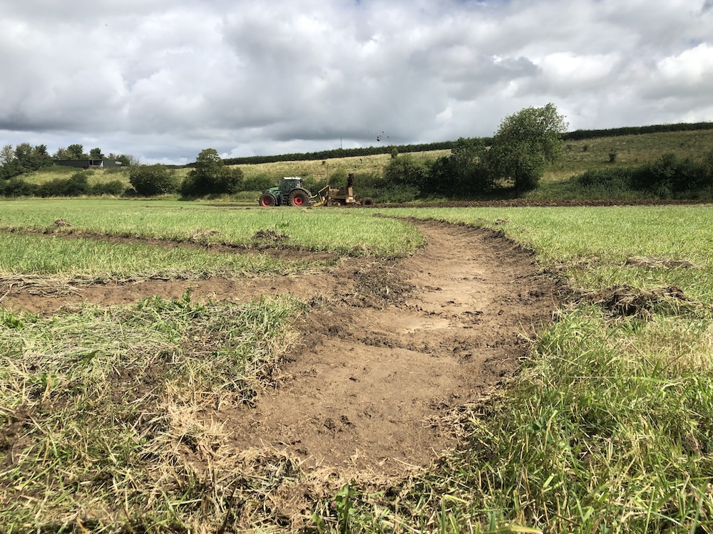
Abbey Farm, Montacute, Wellhams Brook – River Parret catchment. Five interlinked schemes, improving upon works done in early 2016, when the Meeds Valley at Abbey Farm became one of the first places in Somerset to benefit from grants awarded through Hills to Levels. Hills to Levels was then funded through the SRA’s share of Growth Deal money given by the now-defunct Heart of the South West Local Enterprise Partnership. The Meeds Valley is a horseshoe of hills, with springs running into a central ditch, with water flowing down to Montacute, on to Martock and into the River Parrett at Gawbridge Mill. Works done there in 2016 included desilting one pond, digging out and recreating two historic ponds, clearing out the central ditch and installing a series of dams of different sorts.
Following a recent review of all these measures by FWAG SW, five schemes were recommended and carried out. They included maintaining and enhancing existing leaky dams; creating additional dams using large oak timber; repairing a culvert headwall with local stone and improving a track crossing above; building a large timber hibernaculum from locally-felled alder trees to stabilise the headwater area of a spring; and increasing the capacity of a pond and its outlet, clearing silt and weed, making new ponds in a wood, and felling trees to act as flow spreaders within that wood. To save money, a considerable amount of this work was done by the farm’s owners, family and friends. FWAG SW say all these measures have cumulatively reduced peak flows and thereby reduced local flood risks. To help manage water storage during periods of heavy rain, Abbey Farm’s owners have worked closely with local flood wardens, who are very active in the Wellhams Brook area.
Camel Hill Farm, Queen Camel, River Cary catchment. A leaky pond was created to store water running down a steep track from the farmyard, then release it slowly during periods of high flow.
The pond measures 15m2. It has an average depth of 0.5 metres and gently sloping edges. The farmer and FWAG SW say the pond has been working well, with a good amount of water collecting during periods of heavy rain and then receding a couple of days later, most likely due to freely-draining stony soil. It’s the third pond at Camel Hill Farm to have been funded through Hills to Levels. The first in 2017-18 was funded via the SRA using Growth Deal money from the now defunct Heart of the South West Local Enterprise Partnership, the second by the SRA.
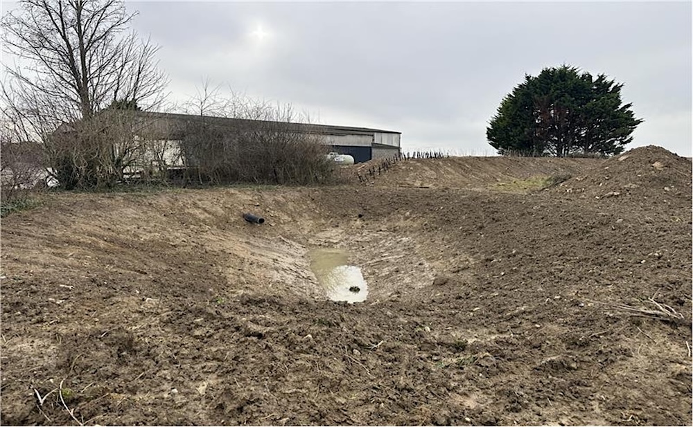
Higher Hill Farm, Shepton Montague, River Pitt catchment, a small scheme developed after several episodes of flooding in Shepton Montague over the last five years, with an especially bad burst in May 2023. Here the basic aim was to reduce the amount of water running down a road into the village. So a swale was created with a bund to hold water, along with a concrete cross-track drain and a sleeper with a pipe in the middle of the sleeper to take excess water from the field, a new ditch and a concrete gully.
Land opposite Gothelney Hall, Charlynch Road, Spaxton parish, Perrymoor Brook to River Parret catchment. A farm track was raised up to field level and sloped from west to east, and three cross drains were built into the track, to get water to soak away into the field, instead of running down onto Charlynch Road, blocking drains with debris and causing flooding.
Initial results have been very promising. A track inspection during heavy rain in February 2025 showed no water running down towards Charlynch Road (highlighted previously as a flooding hotspot by flood wardens and Spaxton Parish Council). The farmer has also created a buffer strip in the field to the west of the track, which has further helped to lessen runoff down towards Perrymoor Brook and the vulnerable area of Perry Green.
Land next to south side of A39 Quantock Road, Wembdon, Cannington Brook – River Parrett catchment. Two interlinked schemes, which began life as a highways referral of a site known for surface water flooding. Somerset Council’s Highways Department asked FWAG SW to investigate opportunities to improve drainage flows and hold back more water in ditches and an existing pond, while at the same time improving access between an agricultural field and a very busy road. A multi-faceted plan was duly drawn up – and carried out – to clear and enhance ditches, reduce land water runoff and pressure on road gullies, increase the capacity of a pond, and generally make this high-risk site safer for farm vehicles and passing traffic.
Sleights Lane, West Coker, Sutton Bingham Stream – River Yeo catchment, chunky lengths of timber and brash were used to create a flow spreader, and some lengths of live hazel were laid across a route long known locally for channelling large fast volumes of water down towards West Coker’s High Street, which is also a busy stretch of the A30. Drains and culverts there have previously been overwhelmed and properties affected during and after periods of heavy rain. To help reduce the risks of road and home flooding, this scheme was developed by FWAG SW working together with West Coker Parish Council, Somerset Council’s Highways Department and two local farmers. It also included some tree planting and hedge-gap filling. It’s the first of a series of land management and natural flood management measures planned around the village to reduce flooding.
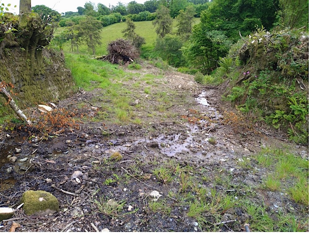
Withycombe Farm, Wiveliscombe, tributary of Hillfarrance Brook, Tone catchment. Three schemes: 1) vegetation clearance and the partial desilting of a disused and heavily sedimented reservoir in a steep-sided valley upstream of Wiveliscombe, along with investigations into difficult outlet problems; 2) installation of a water control outlet to an old mill pond (below), along with timber flow spreaders in places where water flows down into the pond; 3) re-grading and re-profiling of a farm access track (and public footpath) down which torrents of water flowed in heavy rain, and the creation of a bigger deeper silt trap to the side of this track where more water is now diverted and contained and its erosive power reduced. The aim of all these schemes was to hold back and better control water at several points where it naturally converged, and so reduce flooding on the B3227 downhill from the farm, and waterlogging on Wiveliscombe recreation ground. All schemes have been observed to work effectively during heavy rain, also thereby benefitting Withycombe Farm’s buildings and business, and public access.